Vientiane, Laos, 25 July 2018 – The Mekong River Commission is monitoring closely the situation unfolding since 24 July on the flooding in Attapeu in southern Laos due to the incident with the Xe-Pian Xe-Namnoy Hydropower Project.
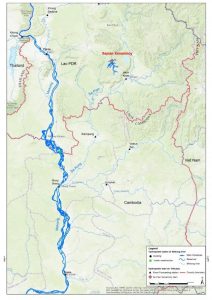
According to a notification document by the Lao government sent to the MRC, the Xe-Pian Xe-Namnoy project is located on the Xe-Pian and Xe-Namnoy Rivers in Champasak (Districts of Paksong, Pathoumphone and Champsack) and Attapeu (Districts of Samakhixay and Sanamxay). The project consists of two major dams – Xe-Pian and Xe-Namnoy – and five saddle dams (smaller auxiliary dams). The Xe-Pian Dam (48 meters high) is a concrete-gravity and earth fill dam, while the Xe-Namnoy (77 meter high) is a clay-core and rock-fill dam.
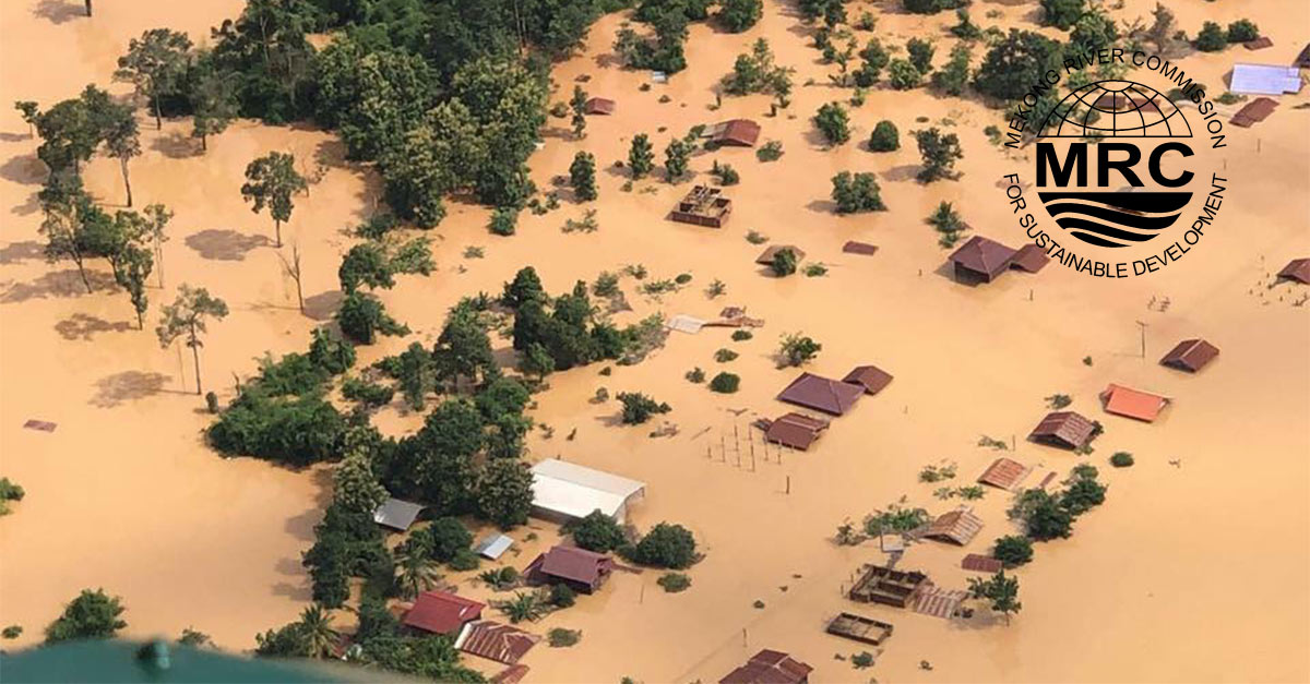
It was reported by Lao state media that, on 23 July, one of the saddle dams failed and unleashed flash flooding into the Xe-Pian river affecting the six villages of Sanamxay District including Yai Thae, Hinlad, Mai, Thasengchan, Tha Hin, and Samong. Hinlad and Mai villages were the hardest hit.
“We express condolences for this national tragedy in Lao PDR. We stand ready to visit the site as well as to provide appropriate support in this time of need,” MRC Chief Executive Officer Pham Tuan Phan said.
The Xe-Pian River (and Xe-Namnoy River) flow into the Xekong River, a major tributary of the Mekong. The distance from the dam to the confluence of the Xekong and Mekong is about 283 km. Located right below the confluence is Stung Treng in Cambodia with Kratie about 124 km further down.

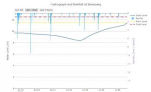
According to the MRC monitoring station in Siem Pang District (Stung Treng in Cambodia) on the Xekong River, the observed water level recorded automatically in 15-min intervals, the water level increased by approximately 3 meters from 4pm of 23 July 2018 till 2pm today. At 4pm on 23 July, the water level at Siem Pang was observed at 8.4m and today, it was observed at 11.4m (at 2:30pm). Siem Pang is about 187km downstream of the dam and 96km upstream of the Xekong – Mekong confluence. This is close to the alarm level of 11.5m.

In the next few days, we expect that the flood water from Xekong together with the flow from the Mekong upstream will cause rising water levels further downstream including in Stung Treng and Kratie. Currently (2.30pm today), the water levels in Stung Treng and Kratie are 9.68m and 19.97m respectively. Alarm levels are NOT expected to be reached within the next few days. The alarm levels in Stung Treng are 10.7m and Kratie is 22.0m.
For updated forecast water levels from MRC, see the daily bulletin.
The Xe-Pian Xe-Namnoy Power Company (PNPC) is a Korean-Thai-Lao joint investment, with 26% from SK Engineering & Construction, 25% Korea Western Power Company, 25% Ratchaburi Electricity Holding, and 24% Lao Holding State Enterprise.
The project, which is estimated to cost US$1.02 billion, is the first build-operate-transfer (BOT) project to be undertaken by South Korean companies in Laos. In addition to electricity generation, the project will also provide irrigation, with 6km channels connected to the powerhouse.
The Lao government notified MRC in September 2013 in accordance with the notification mechanism under the Procedures for Notification, Prior Consultation and Agreement (PNPCA). Notified projects on Mekong tributaries are not required to undergo MRC’s prior consultation process, including assessments. Projects on tributaries follow national laws and regulations.
Source: Mekong River Commission
For more information, please contact:
Ms. Le Thi Huong Lien
Communication Officer
E-mail: huonglien@mrcmekong.org
Phone: +856-21-263263, ext. 4704


